
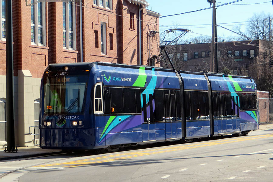
 The Atlanta Streetcar near the original Ebenezer Baptist Church in Atlanta. Georgia Tech researchers have developed a way to improve the timing of the streetcar, eliminating the need for schedules and reducing passenger wait time. (Photo: Spmarshall42 / Wikimedia Commons) |
By Alyson Powell, Institute for People and Technology
Starting this summer, the Atlanta Streetcar will begin using a new real-time dispatching method developed at Georgia Tech that eliminates the need for schedules and cuts down on passenger wait times. Currently, the schedule on the Streetcar is not publicly available to passengers; they only know that streetcars run approximately every 10-15 minutes. Drivers, however, use a schedule in order to make sure the two or three vehicles are evenly spaced along the route. Schedules are made months in advance, though, without information about current operating conditions.
School of Civil and Environmental Engineering Assistant Professor Kari Watkins and Ph.D student Simon Berrebi have developed an algorithm that ensures each vehicle is spaced evenly along the 2.7 mile route in downtown Atlanta, maximizing the frequency of service. Unlike the current method, the Georgia Tech algorithm uses real-time information.
“Our method identifies a late streetcar and holds every proceeding vehicle to make sure that they will all be able to be dispatched with the same headway,” said Berrebi.
One problem the researchers faced was the “urban canyon” effect where the GPS reception reverberates on buildings, or is blocked entirely, creating an error in the signal and causing the apparent GPS location of the vehicles to wander. Watkins and Berrebi worked with Research Scientist Bill Eason of the Georgia Tech Institute for People and Technology and the Georgia Tech Research Network Operations Center (GT-RNOC), and GT-RNOC Co-director Russ Clark to use a barometric pressure sensor. They found that the newest sensors, designed to be built into next-generation cell phones, are sensitive enough to detect changes in elevation of under a meter (3.3 feet). The sensor measures changes in elevation and allows for more accuracy in pinpointing the location of a streetcar in real-time.
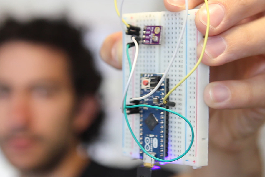 Georgia Tech Ph.D. student Simon Berrebi holds a barometric pressure sensor that measures elevation and pinpoints an Atlanta streetcar in real-time. (Photo: Alyson Powell) |
“Connecting this with the urban canyon problem that we’ve been studying at GT-RNOC, it became clear that we can track the observed elevation changes along the vehicle’s path and match the elevation profile against the known profile for the given path,” said Eason. “Once you can tell where you are on that elevation curve, you can determine exactly where you are on the route.”
Dispatchers will advise drivers how long to stop at a control point located in Centennial Olympic Park, and mobile applications like OneBusAway, along with LED displays located at streetcar stops will notify passengers of expected arrival times. Researchers will work to expand this system to other transit routes in Atlanta and throughout the country.
This method is particularly easy for fixed routes like those that the streetcars travel. It becomes a bit more difficult for tracking the location of vehicles like buses that may have to detour off the planned route because of road closures and other obstructions, but the Georgia Tech research team is solving those problems, too.
“The uniqueness of this solution is that the sensor is self-contained and doesn’t depend on external signals (like from GPS satellites) or even comparative air pressure measurements taken at a second, fixed location,” explained Eason. “The algorithm we’ve created is robust enough to handle macro changes in atmospheric pressure as the weather changes, without affecting the ability to determine a vehicle’s location. It’s exciting to be developing new technologies like this, while applying them to real-world solutions that affect people’s lives and benefit the city we live in.”
Eason notes that this technique will only work in areas where the roads have enough rise and fall to create an elevation profile that we can follow. Coastal Florida might not be a good target area, but Atlanta certainly is.
Although the Atlanta Streetcar project has recently faced growing pains and a possible shutdown, Berrebi is hopeful that it will continue to expand and that Atlanta can one day have a public transit system similar to his native Paris.
“For me, public transportation is a way of life,” he said. “When I came to Atlanta I was shocked that public transit wasn’t what I was used to. I started working with Dr. Kari Watkins who had a mission to improve public transportation in Atlanta, and I was inspired immediately by her work and wanted to participate.”
The streetcar project is in partnership with the Georgia Tech Center for Urban Innovation and the City of Atlanta, and is funded by a GVU/IPaT Engagement Grant, which provides seed funding to conduct interdisciplinary research. Engagement grants are designed to foster new sorts of engagements and collaboration, whether internally or externally.